€ 549
Per Person, Min. 2 People
- Duration: 4 days
- Difficulty: 4/5 (hard)
- Recommended Seasons: Spring - Summer
- Height Diff.: 3000mt / 9800 ft
- Lenght: 39Km / 24ml
- Location: Mont Avic Natural Park, Aosta Valley
- Area: Gran Paradiso -
- Tags: 4 days hike, 4000 meters views, animals, difficulty 4/5 (hard hikes), spring, summer
INFO REQUEST
Remember!
Dates and features of our hikes are flexible: we can build together the adventure that is tailored to your needs.
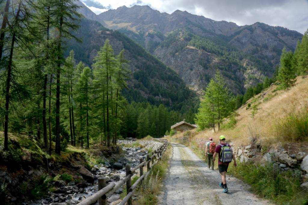
Just Contact Us!Mont Avic Natural Park Hiking
Mont Avic Natural Park Hiking is the second park of Aosta Valley and is located in the Champorcer and Champendraz
DISPLAY FULL DESCRIPTION
Details
-
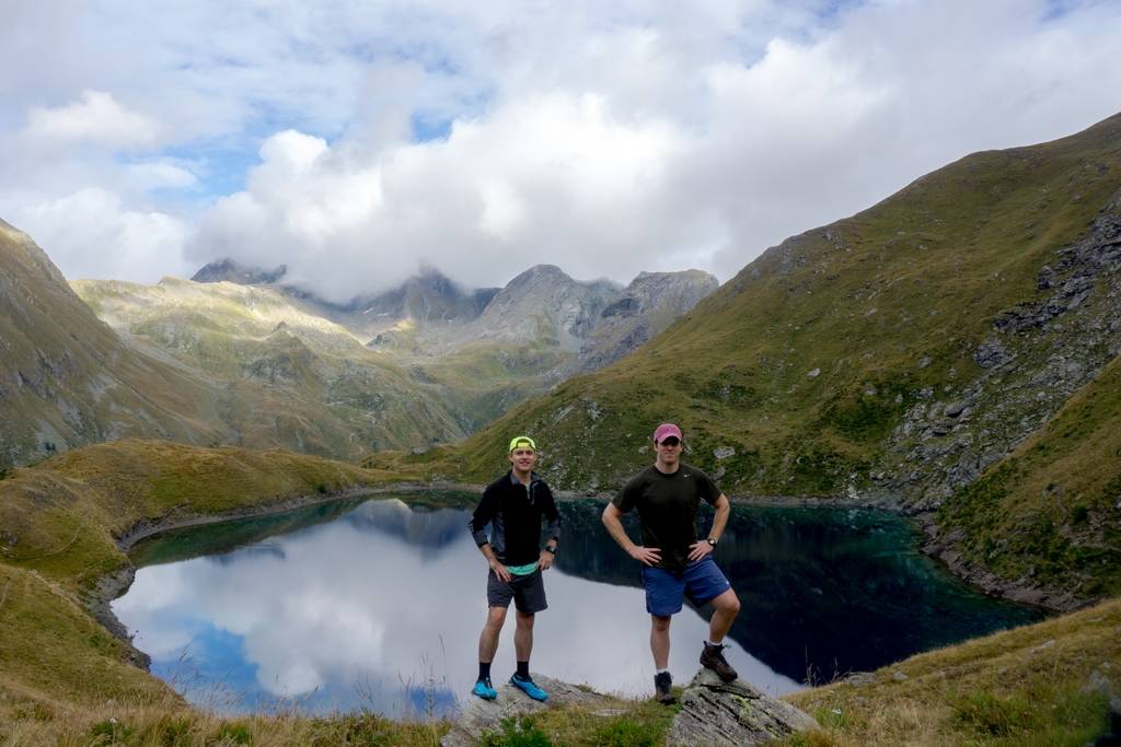
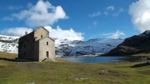
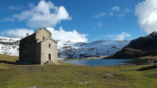
Overnight Staying DetailsTwo night in a shelter and one night in unguarded hutHighest PoingPorta Pass (Colle della Porta) 3002m – 9850ftSettingGranite Walls, Lakes, GlaciersSpecial Features and Points of InterestWilderness, Balcony Trail: Views!Animals you may encounterProbable: Marmot, Ibex, Chamois – Rarely: Eagle, Volture, Ermine and FoxFamilyFit for children but we’ll need to change the itinerary to make it milder
-
WHAT YOU NEED
- Backpack (30-50 liters) – Rent Possible
- Hiking Boots – Rent Possible
- Light Sleeping bag – Rent Possible
- 1 t-shirt per day
- 1 fleece
- 1 jacket against cold
- 1 jacket against rain
- 2 extra socks
- 1 comfortable trouser
- 1 shorts
- 1 water bottle
- Hat and gloves
- Suncream
- Sun glasses
- Spirit of Adventure!
THE COST INCLUDES
- Hiking Guide
- Trasportation from Torino till the Mountain area and back (free service)
- Overnight staying (directly to the shelter)
- One meal per day (home made dinner at unguarded huts)
- Suggestions for the organization of your trip (free service)
WHAT IS NOT INCLUDED
- Other Meals
- Air ticket till Torino
POSSIBLE EXTENSIONS AND CHANGES
In all Trekking Alps hikes there is a high degree of flexibility. Difficulty and duration of the hike can be changed and accomodation in bed and breakfast or hotel can be arranged. Just write an email at info@trekking-alps.com or write us a WhatsApp at +393386608548 -

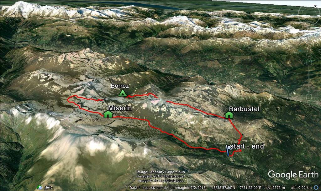
To watch the animated 3d map Click Here
-


Video
Video
This Trekking Day by Day
-
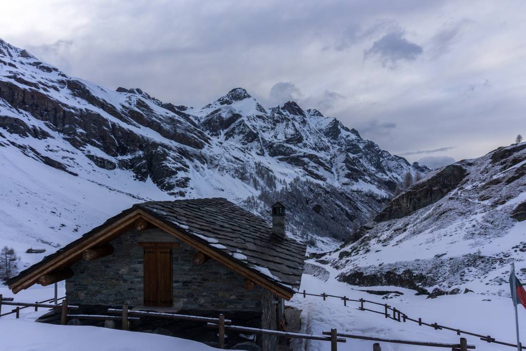
Champorcher (1420m) – Rif. Miserin(2630m)
6 hours – 10 Km
Elevation up: 1200m Elevation down:0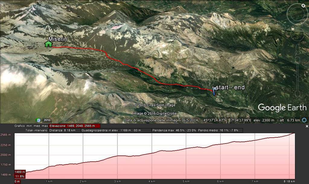
-
Rif. Miserin(2630m) – Biv. Borroz(2260m)
7 hours – 12 Km
Elevation up: 700m Elevation down: 1100m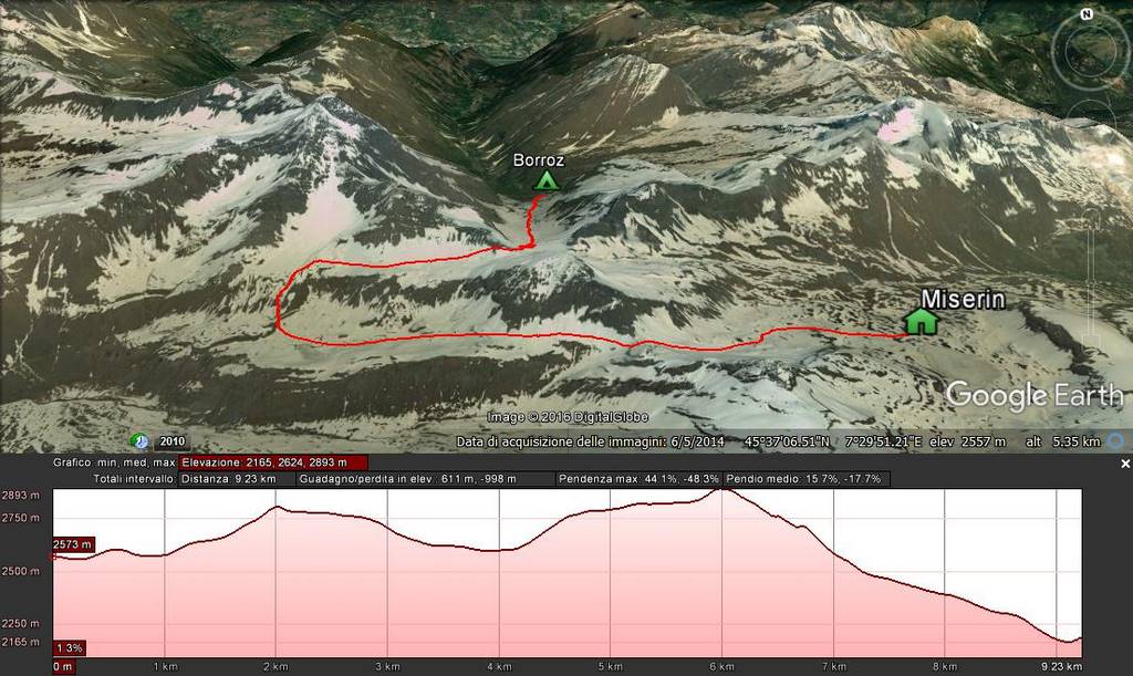
-
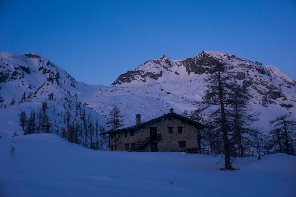
Biv. Borroz(2260m) – Rif. Barbustel(2200m)
7 hours – 12Km
Elevation up: 1000m Elevation down:1000m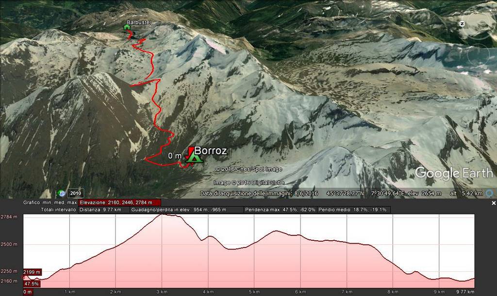
-
Rif. Barbustel(2200m) – Champorcher (1420m)
2 hours – 5 Km
Elevation up: 100m Elevation down:900m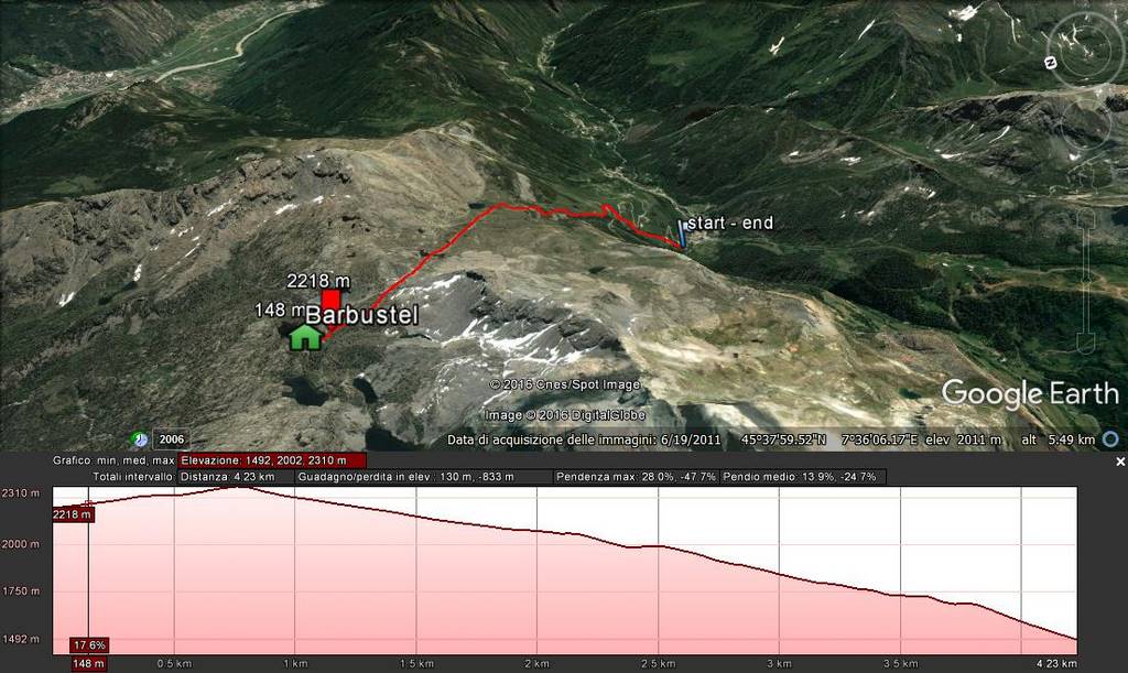
Join
A Planned Hike
A Planned Hike
This hike has not been booked yet
Why Join?
Join one of the planned hikes and save money sharing the costs of the trek with other people in our Alps trekking tour. Check the next mountain hiking tour in the Trekking Alps Calendar and plan your trekking in Italy with us. In joining an hike you will be part of a lovely international environment.Configure
Your Hike
Your Hike
Few Steps to find your ideal Hike!
Start clicking on the season