- Duration: 5 days
- Difficulty: 2/5 (easy)
- Recommended Seasons: Summer
- Height Diff.: 2900mt / 9514 ft
- Lenght: 28Km / 17ml
- Location: Susa Valley
- Area: Turin Alps -
- Tags: 5 days hike, children, cultural & historic places, difficulty 2/5 (easy hikes), summer
€ 649
Per Person, Min. 2 People
INFO REQUEST
Remember!
Dates and features of our hikes are flexible: we can build together the adventure that is tailored to your needs.
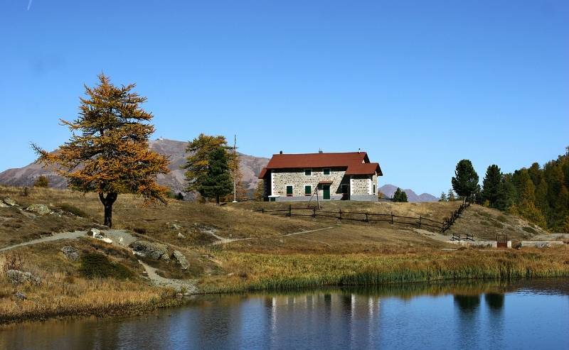
Just Contact Us!Walking Holidays in Balcony Trail
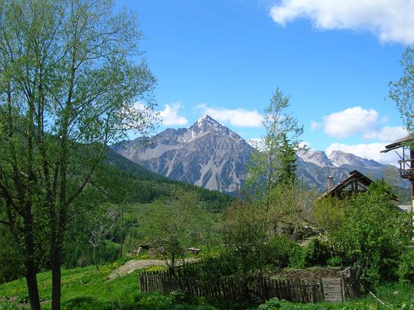
Balcony Trail of Susa Valley it is a magnificent walking holiday and it was recently officially enhanced by Piedmont region
DISPLAY FULL DESCRIPTION

Details
-
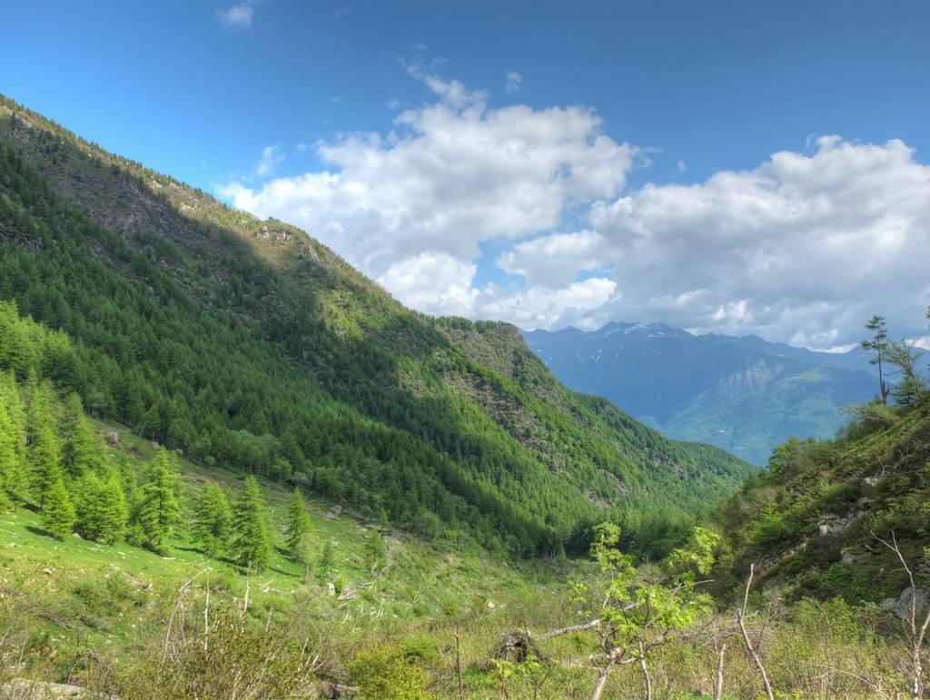
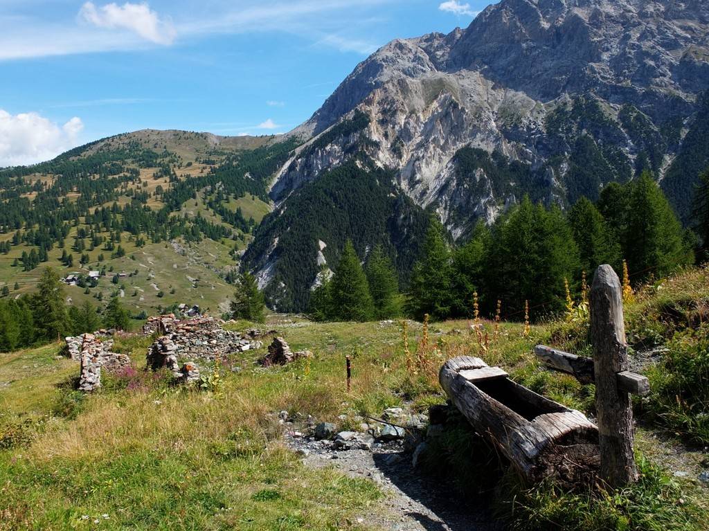
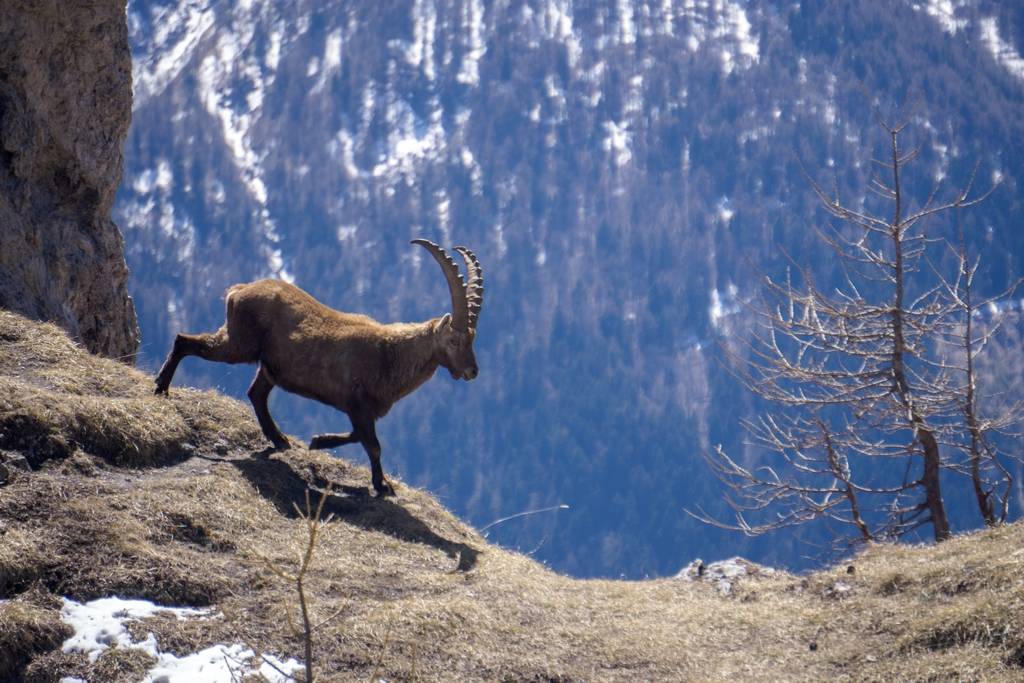
Overnight Staying Details4 nights in ShelterHighest PoingGimont peak 2645m – 8667 ftSettingForests, Meadows, RocksSpecial Features and Points of InterestShort daily hiking, Lakes, AnimalsAnimals you may encounterProbable: Marmots, Chamois, FoxFamilyExcellent trekking for everyone. Short walks but always on safe and beautiful path.
-
WHAT YOU NEED
- Backpack (30-50 liters) – Rent Possible
- Hiking Boots – Rent Possible
- Light Sleeping bag – Rent Possible
- 1 t-shirt per day
- 1 fleece
- 1 jacket against cold
- 1 jacket against rain
- 2 extra socks
- 1 comfortable trouser
- 1 shorts
- 1 water bottle
- Hat and gloves
- Suncream
- Sun glasses
- Spirit of Adventure!
THE COST INCLUDES
- Hiking Guide
- Trasportation from Torino till the Mountain area and back (free service)
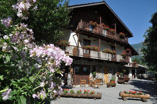
- Overnight staying (directly to the shelter)
- One meal per day (directly to the shelter)
- Suggestions for the organization of your trip (free service)
WHAT IS NOT INCLUDED
- Other Meals
- Air ticket till Torino
POSSIBLE EXTENSIONS AND CHANGES
In all Trekking Alps hikes there is a high degree of flexibility. Difficulty and duration of the hike can be changed and accomodation in bed and breakfast or hotel can be arranged. Just write an email at info@trekking-alps.com or write us a WhatsApp at +393386608548 -
To watch the animated 3d map Click Here
-


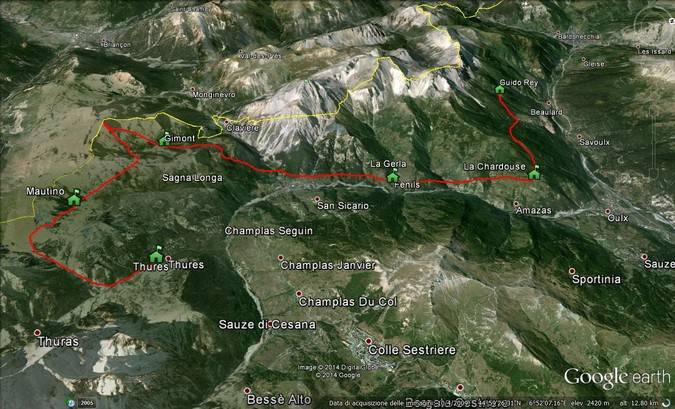
This Trekking Day by Day
-
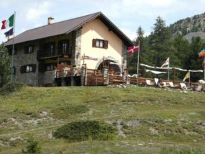
Guido Rey (1817m) – Rif. La Chardouse(1650m)
3-4 hours – 5 Km
Elevation up: 600m Elevation Down: 800m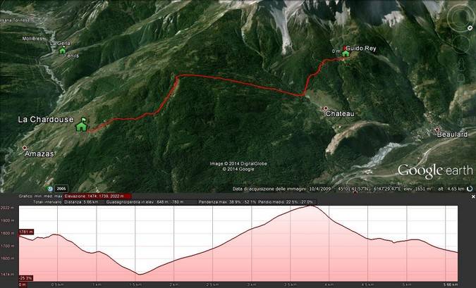
-
Rif. La Chardouse(1650m) – Fenils(1300m)
2-3 hours – 4 Km
Elevation up: 200m Elevation down: 500m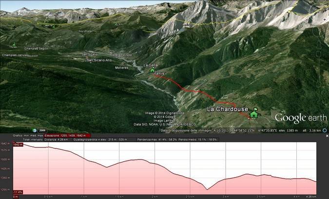
-
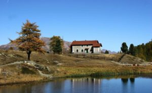
Fenils(1300m) – Baita Gimont(2035m)
4-5 hours – 7 Km
Elevation up: 900m Elevation down: 200m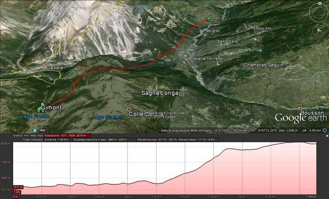
-
Baita Gimont(2035m) – Capanna Mautino(2110m)
4-5 hours – 7 Km
Elevation up: 700m Elevation down: 800m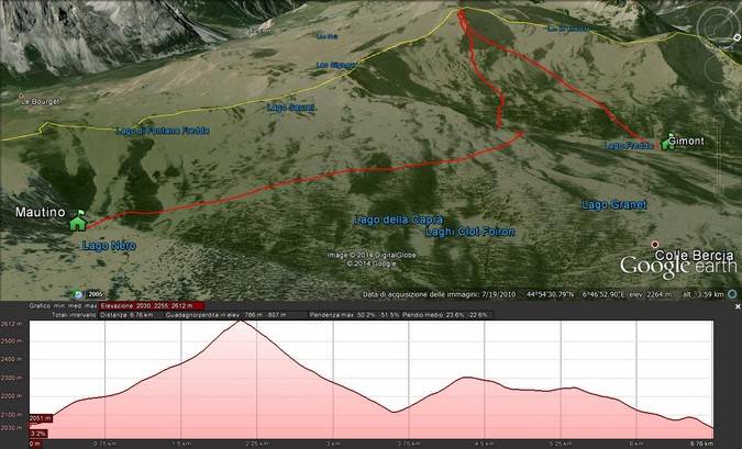
-
Capanna Mautino(2110m) –Thures(1650m)
4-5 hours – 6 Km
Elevation up: 400m Elevation down: 800m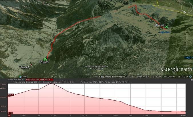
Join
A Planned Hike
A Planned Hike
This hike has not been booked yet