- Duration: 4 days
- Difficulty: 4/5 (hard)
- Recommended Seasons: Summer
- Height Diff.: 3100mt / 9800 ft
- Lenght: 52Km / 33ml
- Location: Cogne Valley
- Area: Gran Paradiso -
- Tags: animals, 4 days hike, 4000 meters views, difficulty 4/5 (hard hikes), summer
€ 799
Per Person, Min. 2 People
INFO REQUEST
Remember!
Dates and features of our hikes are flexible: we can build together the adventure that is tailored to your needs.
Just Contact Us!Cogne Hiking Tour
Many asked me to organize a Cogne Hiking Tour and finally I designed it! Cogne is a paradise on Earth.
DISPLAY FULL DESCRIPTION

Details
-
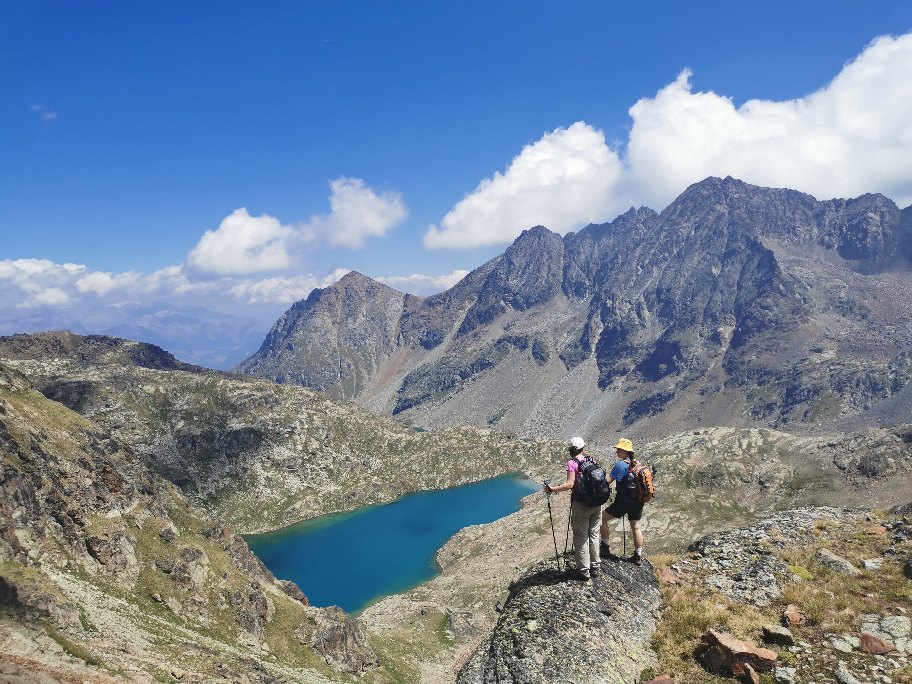
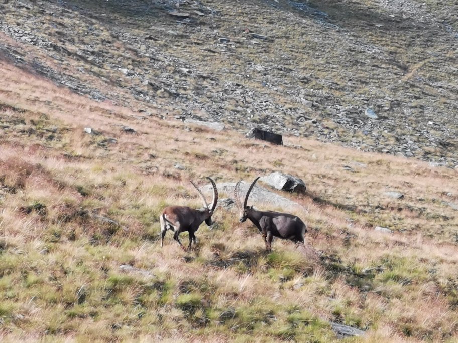
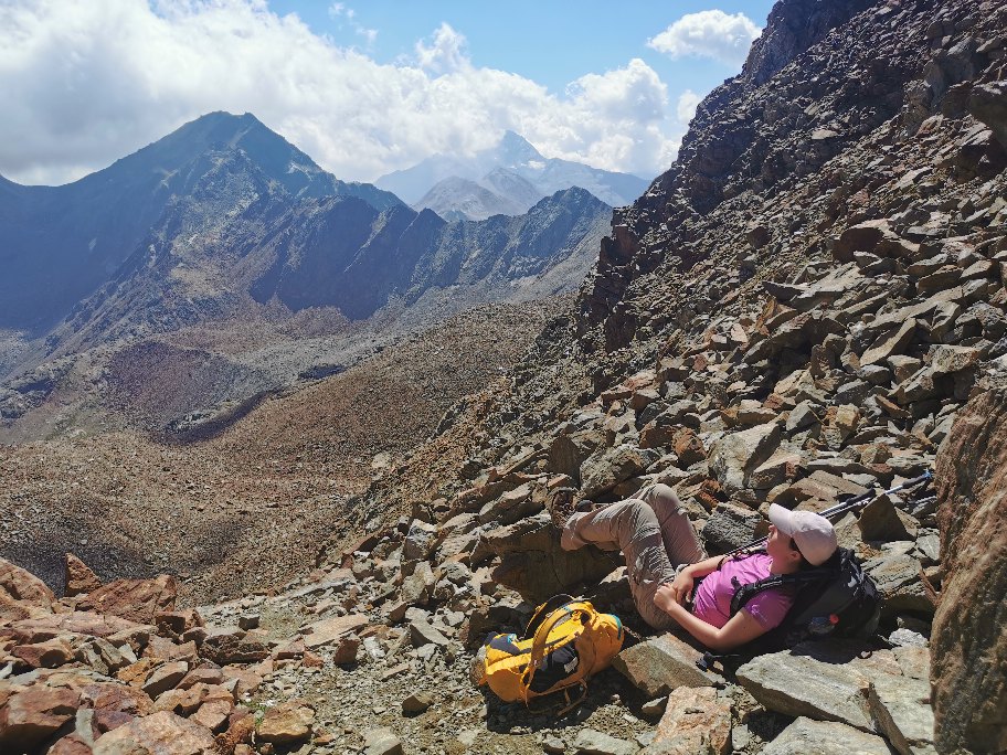
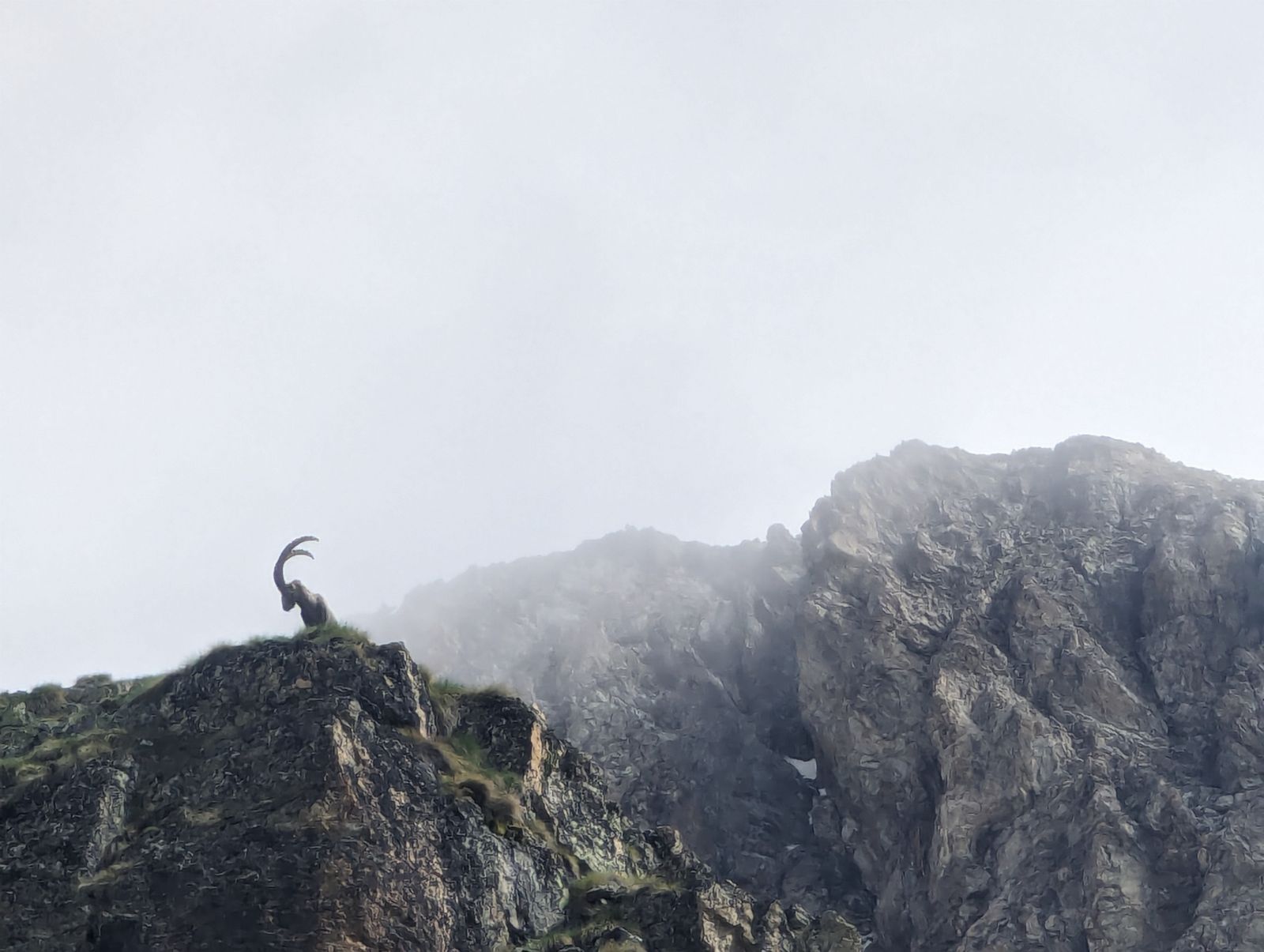
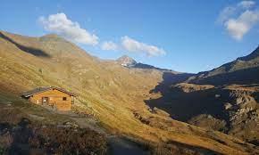
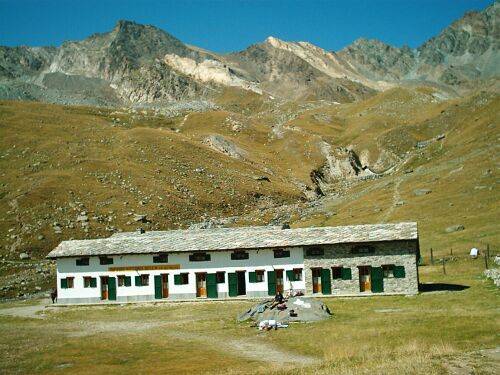
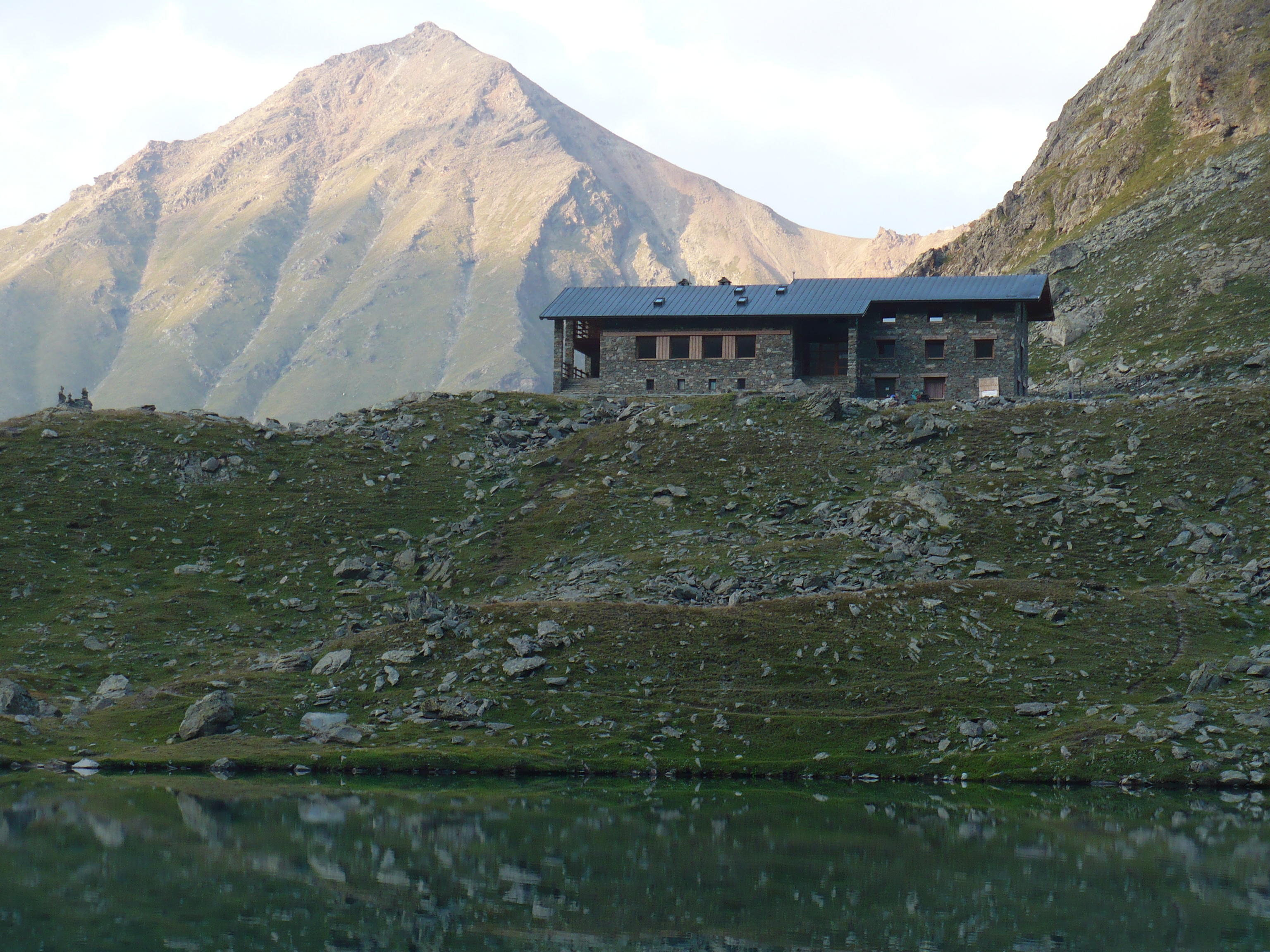
Overnight Staying Details3 nights in Shelter/LodgeHighest PoingArbolle Pass(Colle della Porta) 3150m – 10050ftSettingAlpine meadows, Forests, Glaicers ViewSpecial Features and Points of InterestWildlife, Gran Paradiso Peak view, Cogne ValleyAnimals you may encounterProbable: Marmot, Ibex, Chamois – Possible: Eagle, Volture, Ermine and FoxFamilyFit for teenagers
-
WHAT YOU NEED
- Backpack (30-40 liters) – Rent Possible
- Hiking Boots – Rent Possible
- Light Sleeping bag/Liner – Rent Possible
- 1 t-shirt per day
- 1 fleece
- 1 jacket against cold
- 1 jacket against rain
- 2 extra socks
- 1 comfortable trouser
- 1 shorts
- 1 water bottle
- Hat and gloves
- Suncream
- Sun glasses
- Spirit of Adventure!
THE COST INCLUDES
- Hiking Guide
- Trasportation from Torino till the Mountain area and back (free service)
- Overnight staying (directly to the shelter)
- One meal per day (home made dinner at unguarded huts)
- Suggestions for the organization of your trip (free service)
WHAT IS NOT INCLUDED
- Other Meals
- Air ticket till Torino
- Health Insurance
POSSIBLE EXTENSIONS AND CHANGES
In all Trekking Alps hikes there is a high degree of flexibility. Difficulty and duration of the hike can be changed and accomodation in bed and breakfast or hotel can be arranged. Just write an email at info@trekking-alps.com or write us a WhatsApp at +393386608548 -


This Trekking Day by Day
-
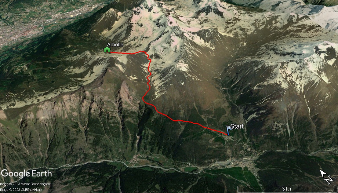
Gimillan(1800m)- Col Garin(2850m) - Rif. Arbolle(2507m) Elevation Up: 1000+ Elevation Down: 400m Distance: 12Km
-
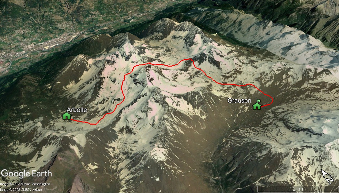
Rif. Arbolle(2507m) - Col Arbolle(3154m) - Col Laures(3035m)- Rif. Grauson(2510m) Elevation up: 800 Elevation down: 800 Distance: 15Km
-
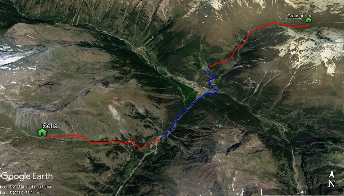
Rif Grauson(2510m) - Gimillan(1800m) - Transfer to Valnontey(1650m) -Rif. Sella(2588m) - Elevation Up: 1000m Elevation down 800m Distance - 15Km
-
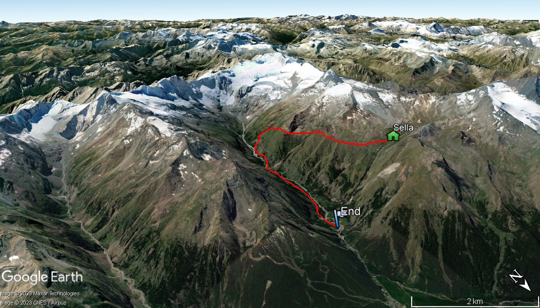
Rif. Sella(2577m) - Herbetet(2000m) - Valnontey(1650m) - Elevation up: 300m Elevation down: 1200m Distance 13Km
Join
A Planned Hike
A Planned Hike
This hike has not been booked yet
Why Join?
Join one of the planned hikes and save money sharing the costs of the trek with other people in our Alps trekking tour. Check the next mountain hiking tour in the Trekking Alps Calendar and plan your trekking in Italy with us. In joining an hike you will be part of a lovely international environment.Cogne Hiking Tour
TESTIMONIALS
Real adventure!
This is our second hike with Roberto. Our first a one day hike and our second a 3 day trip staying in unguarded huts. Roberto is funny, kind, knowledgeable and a pleasure to spend time with. I would recommend this company to anyone wanting to get the best experience of the Italian alps.
 Leah – United Kingdom