- Duration: 5 days
- Difficulty: 3/5 (medium)
- Recommended Seasons: Autumn - Summer
- Height Diff.: 3800mt / 12460ft
- Lenght: 38Km / 23.63ml
- Location: Susa Valley
- Area: Turin Alps -
- Tags: 5 days hike, animals, autumn, cultural & historic places, difficulty 3/5 (medium hikes), summer, ∆trekking peak
€ 799
Per Person, Min. 2 People
INFO REQUEST
Remember!
Dates and features of our hikes are flexible: we can build together the adventure that is tailored to your needs.
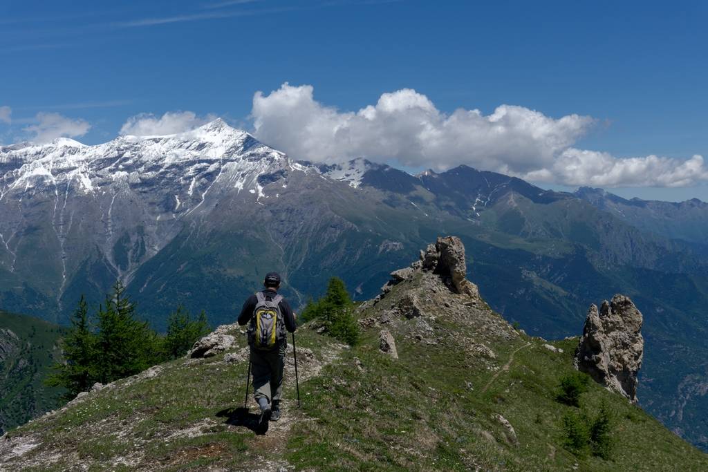
Just Contact Us!Susa Valley Ring Trek
The Tour of Ambin is located in Susa Valley and it is a breathtaking hiking route that crosses the Italian
DISPLAY FULL DESCRIPTION
Details
-
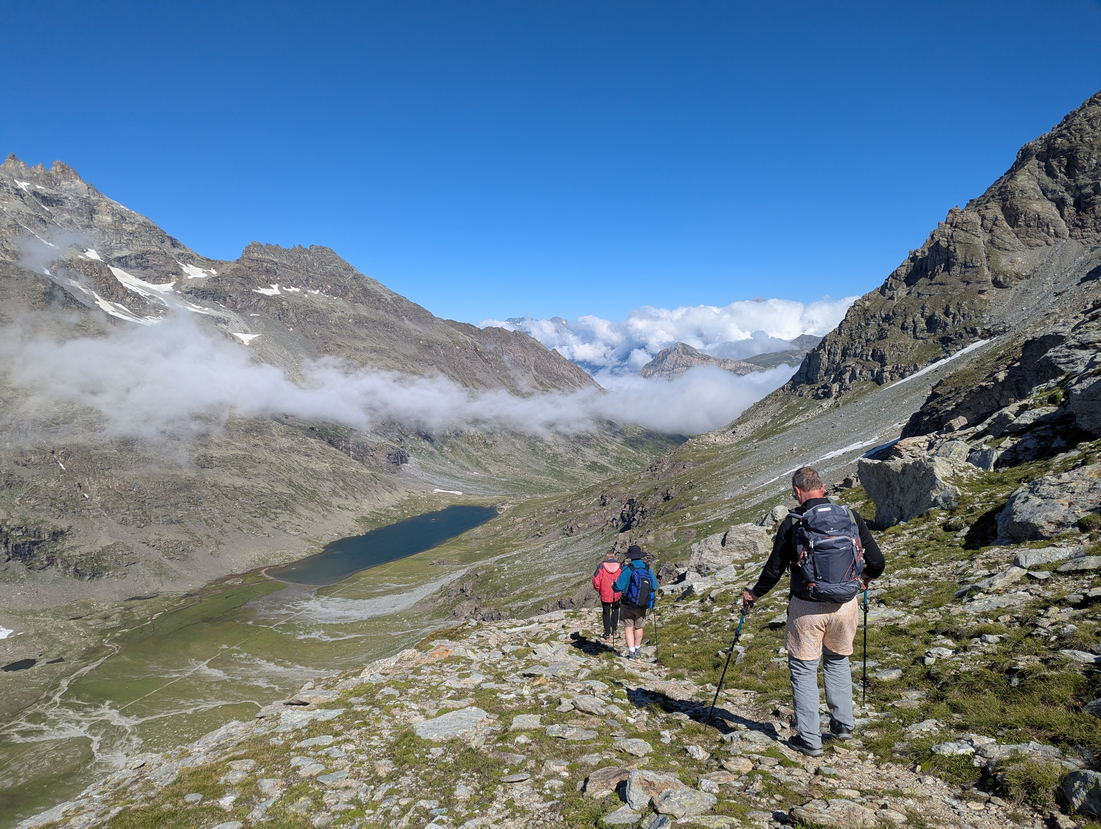
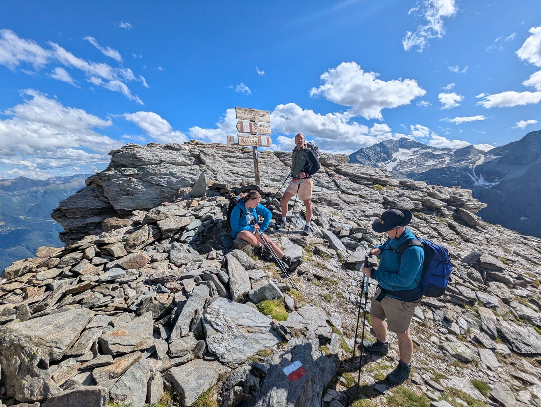
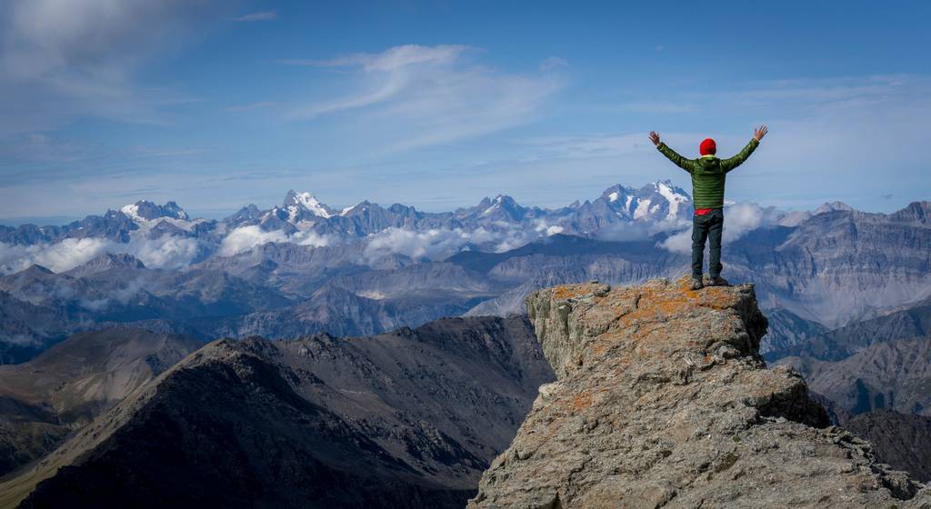
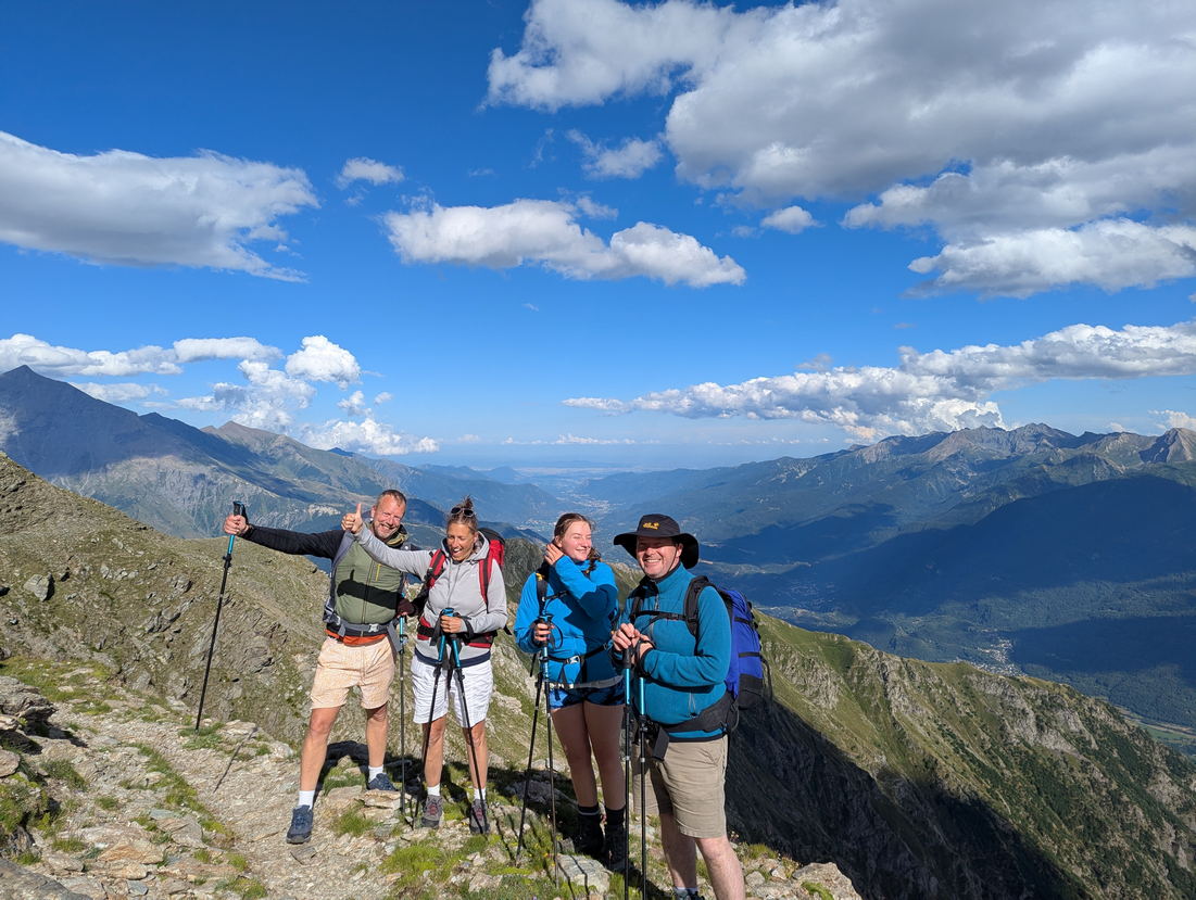
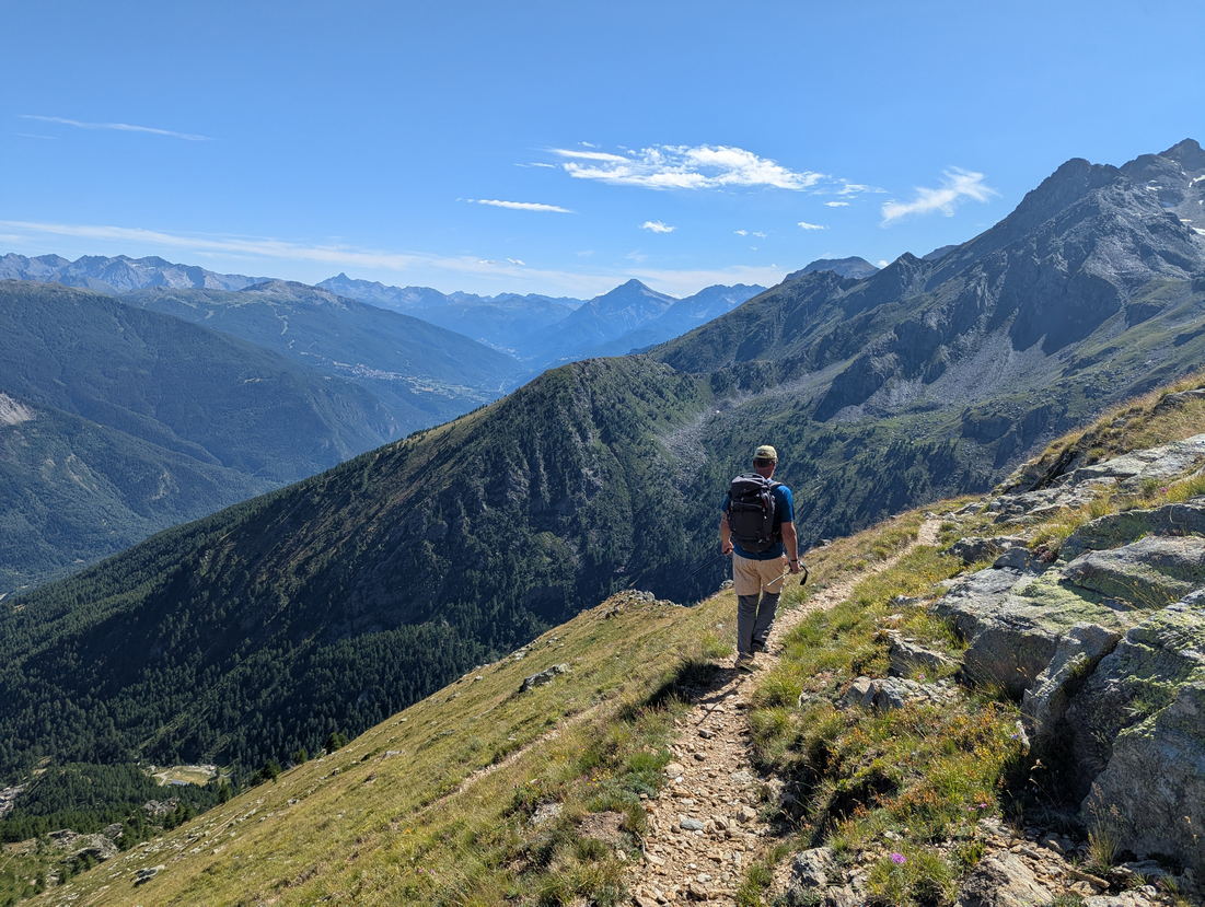
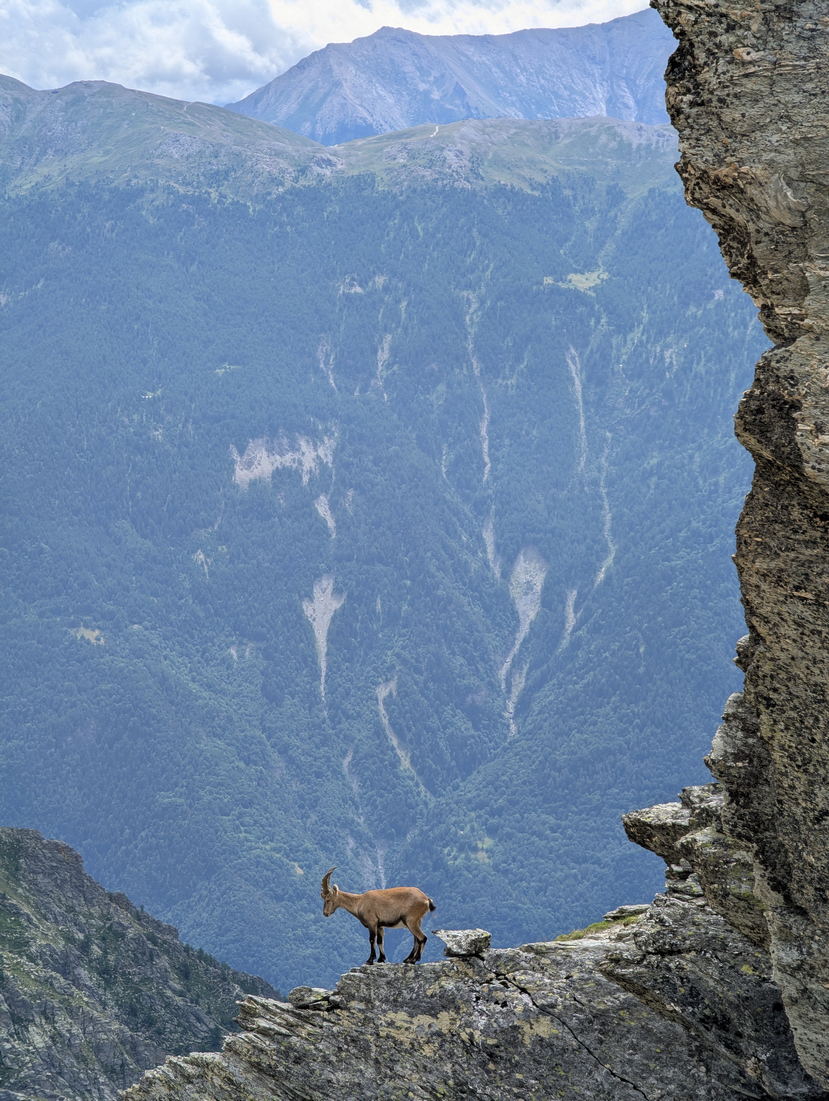
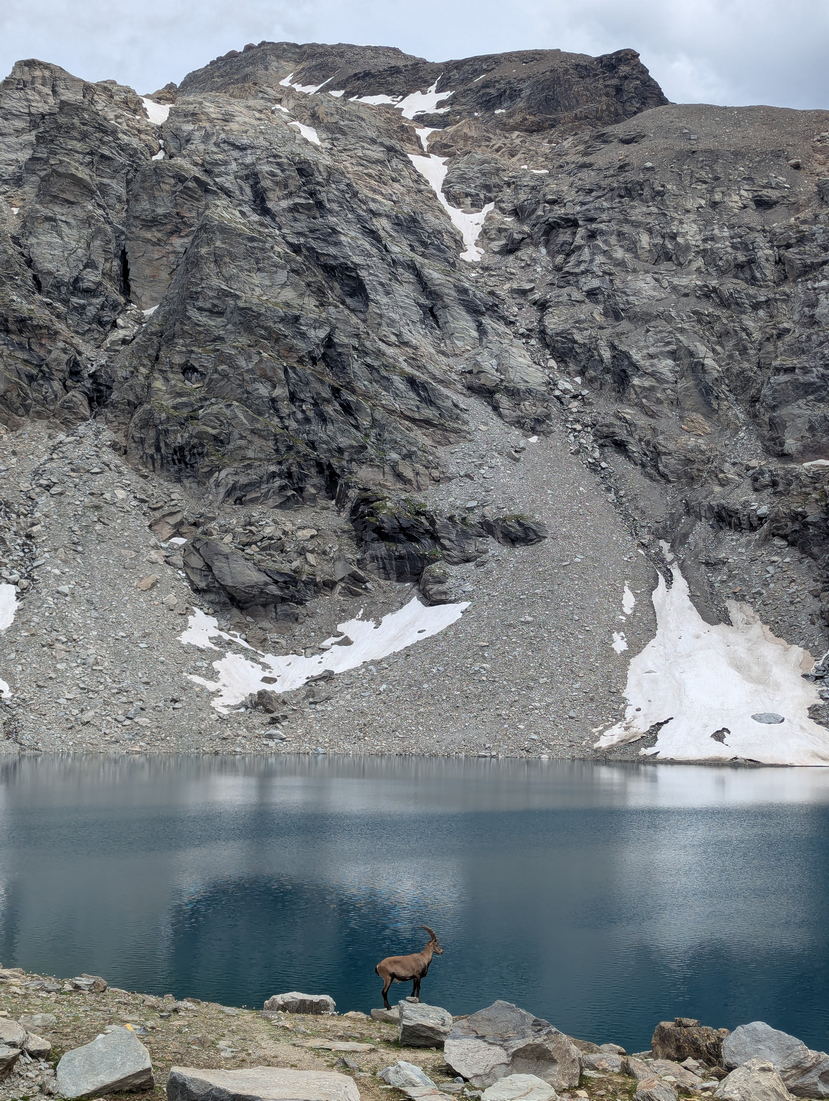
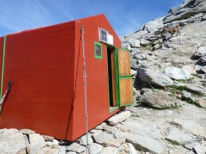
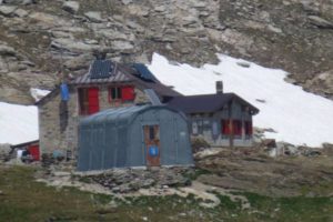
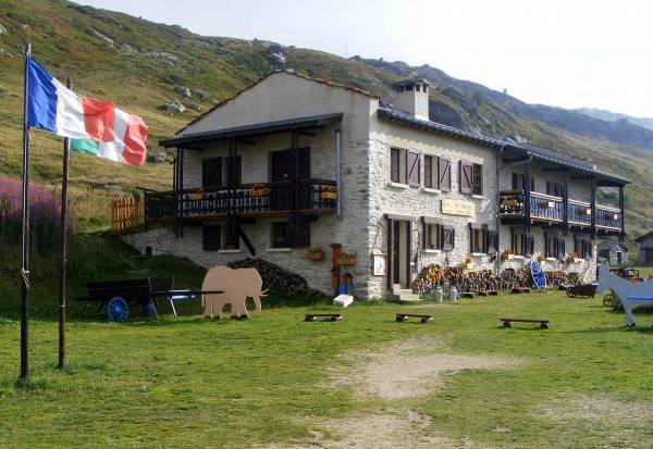
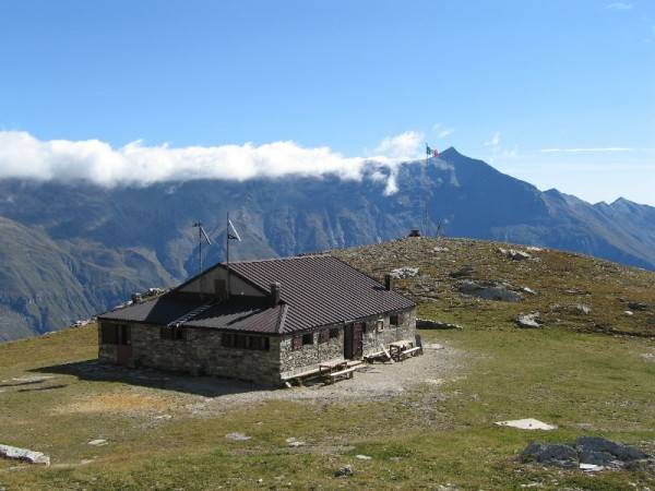
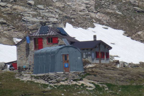
Overnight Staying DetailsTwo nights in a shelter and two night in unguarded hutHighest PoingGiusalet Peak 3313m – 10869ftSettingForests, Meadows, RocksSpecial Features and Points of InterestWilderness, Animals, HistoryAnimals you may encounterProbable: Marmots, Chamois, Deers, Ermines, IbexFamilyExcellent trekking for active children. Long walks but always on safe and beautiful path
-
WHAT YOU NEED
- Backpack (30-50 liters) – Rent Possible
- Hiking Boots – Rent Possible
- Light Sleeping bag – Rent Possible
- 1 t-shirt per day
- 1 fleece
- 1 jacket against cold
- 1 jacket against rain
- 2 extra socks
- 1 comfortable trouser
- 1 shorts
- 1 water bottle
- Hat and gloves
- Suncream
- Sun glasses
- Spirit of Adventure!
THE COST INCLUDES
- Hiking Guide
- Trasportation from Torino till the Mountain area and back (free service)
- Overnight staying (directly to the shelter)
- One meal per day (directly to the shelter)
- Suggestions for the organization of your trip (free service)
WHAT IS NOT INCLUDED
- Other Meals
- Air ticket till Torino
POSSIBLE EXTENSIONS AND CHANGES
In all Trekking Alps hikes there is a high degree of flexibility. Difficulty and duration of the hike can be changed and accomodation in bed and breakfast or hotel can be arranged. Just write an email at info@trekking-alps.com or write us a WhatsApp at +393386608548 -
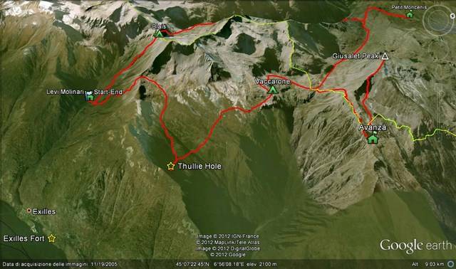
To watch the animated 3d map Click Here
-


This Trekking Day by Day
-
Levi-Molinari(1850m) – Blais (2921m)
3-4 hours – 4Km
Elevation up: 1000m Elevation Down: 0m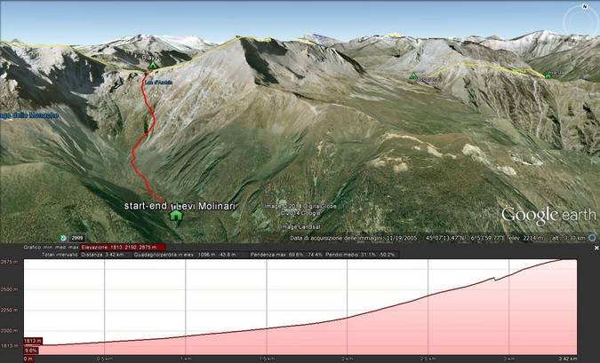
-
Blais (2921m) – Rifugio Petit Moncenis(2110m)
5-7 hours 12Km
Elevation up: 500m Elevation Down: 1300m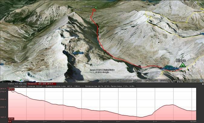
-
Rifugio Petit Moncenis(2110m) – Rifugio Avanzà(2578m)
5 hours – 10,5 Km
Elevation up: 900m Elevation Down: 600m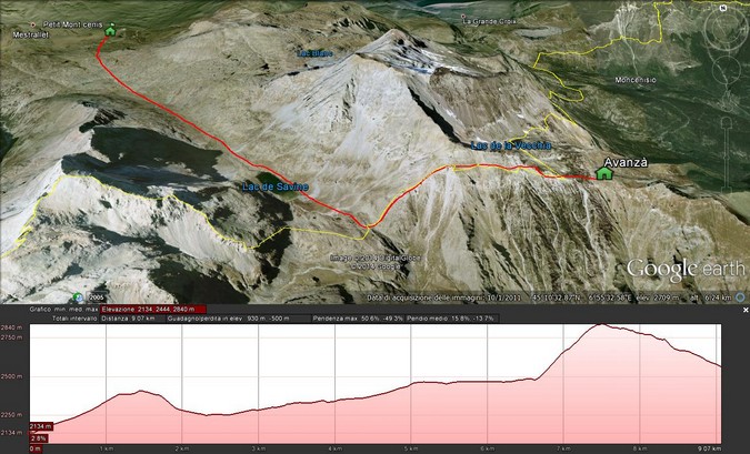
-
Rifugio Avanzà(2578m) – Rifugio Vaccarone(2743m)
7 hours – 12Km
Elevation up: 1400m Elevation Down: 1400m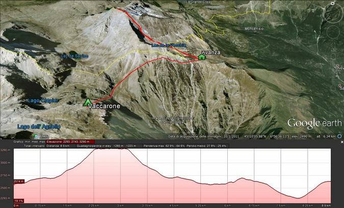
-
Rifugio Vaccarone(2743m) – Thullie Hole – Levi Molinari(1850m)
6 hours – 8,5 Km
Elevation up: 800m Elevation Down: 1600m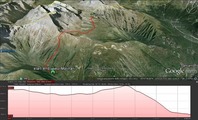
Join
A Planned Hike
Why Join?
Join one of the planned hikes and save money sharing the costs of the trek with other people in our Alps trekking tour. Check the next mountain hiking tour in the Trekking Alps Calendar and plan your trekking in Italy with us. In joining an hike you will be part of a lovely international environment.Susa Valley Ring Trek
TESTIMONIALS
A real memorable challenge!
It’s a challenging and beautiful experience! For sure to be repeated! Out of my comfort zone, with few moments where a beter preparation in the future will be required. Roberto was kind helpful and fun! Everything was good arranged. Thank you Roberto! It’s was a great week!
 Teodora - Romania
Fantastic Experience in the Italian Alps!
Roberto guided my wife and me for four fantastic days in June. We had some unusual requests and he was able to accomodate them perfectly. His knowledge of the area, his pleasant personality, kindness and sense of humor made the time memorable beyond words. His choice of routes was amazing and he went out of his way to share the local history and culture with us. He gave us several choices for accomodations and then met our requests in a way that exceeded our expectations. He even took us to a local sporting goods shop (Ferrino Store in Torino) so my wife could be fitted for the first pair of hiking boots (branded AKU) that actually fit her. She would wear them to bed if she could. He also turned out to be a huge NBA fan and we had several long discussions about basketball as we labored up the more strenous terrain. I would recommend Roberto to experts and beginners alike as he will undoubetdly deliver a great trip.
 Robert - USA