- Duration: 4 days
- Difficulty: 3/5 (medium)
- Recommended Seasons: Autumn - Summer
- Height Diff.: 3200mt / 10498ft
- Lenght: 28Km / 17.48ml
- Location: Lanzo and Susa Valleys
- Area: Turin Alps -
- Tags: 4 days hike, autumn, difficulty 3/5 (medium hikes), summer, ∆trekking peak
€ 499
Per Person, Min. 2 People
INFO REQUEST
Remember!
Dates and features of our hikes are flexible: we can build together the adventure that is tailored to your needs.
Just Contact Us!Rocciamelone Peak Trekking
This trekking is meant for anybody who wants to experience a real mountain environment and reaching an unforgettable Rocciamelone peak.
DISPLAY FULL DESCRIPTION
Details
-
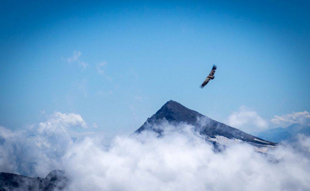
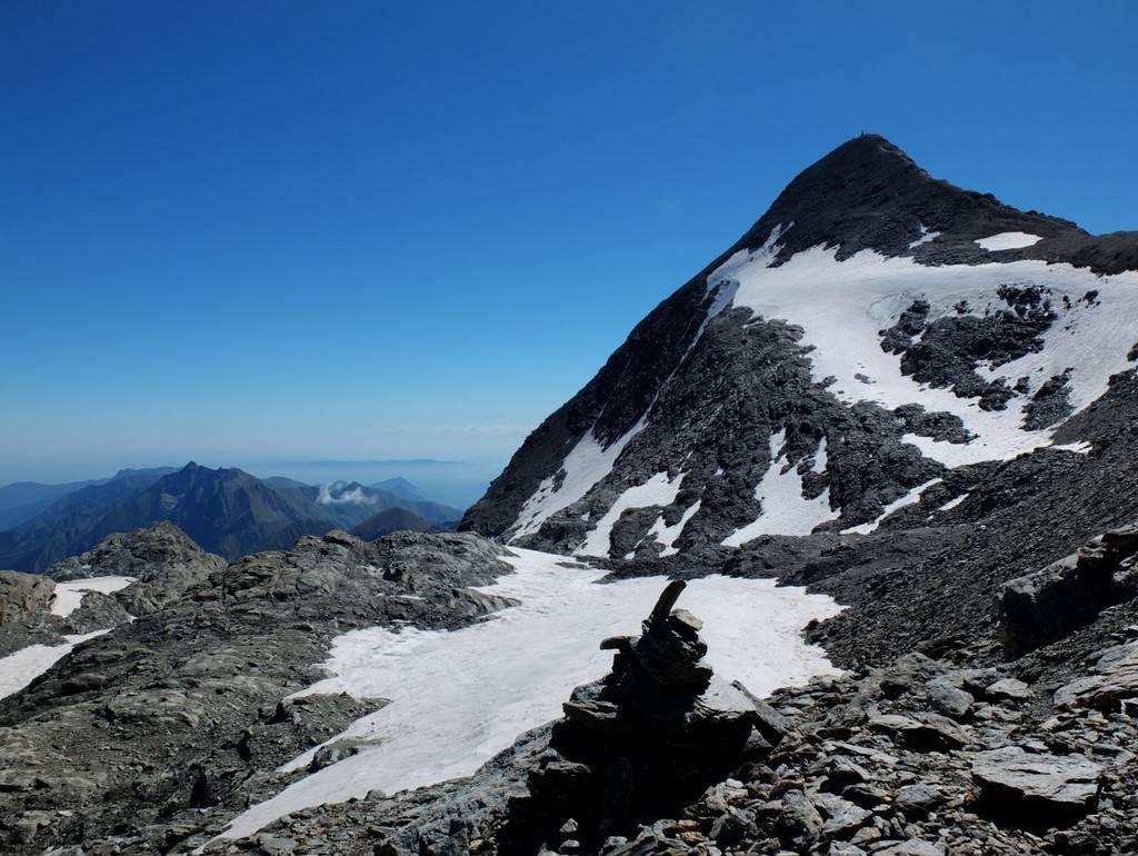
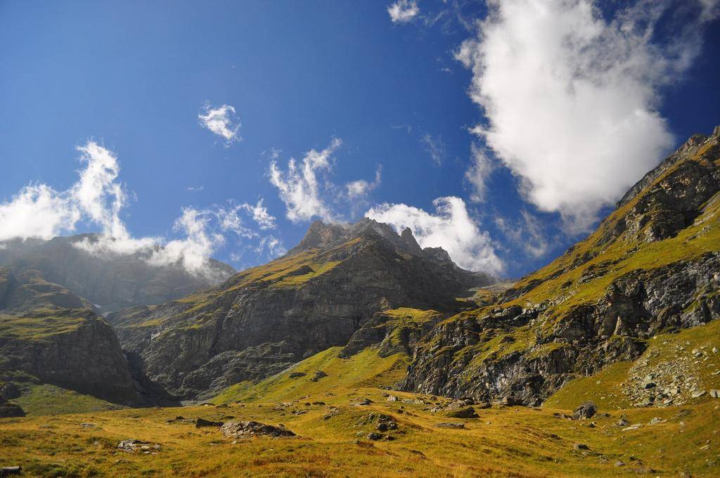
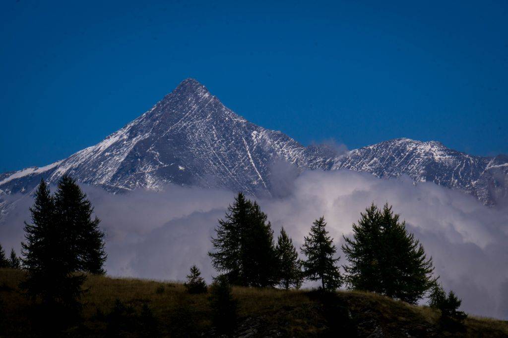
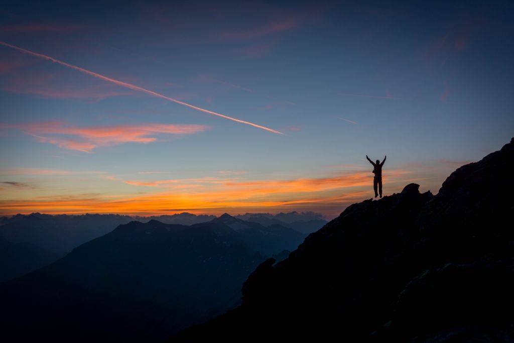
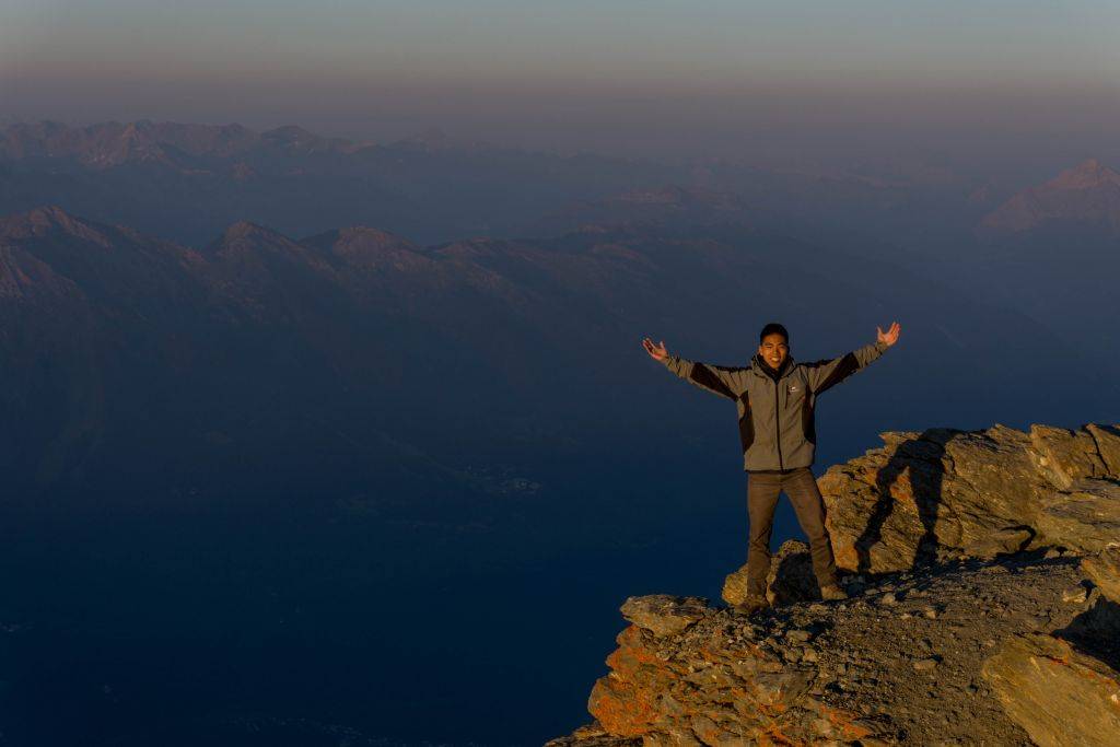
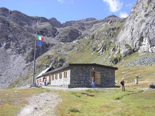
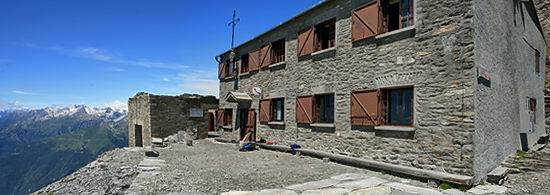
Overnight Staying DetailsTwo nights in a shelter and one night in unguarded hutHighest PoingRocciamelone Peak 3538m – 11607ftSettingRocks, Lakes, High Mountain EnvironmentSpecial Features and Points of InterestRocciamelone Peak (3538m) – It is possible to sleep on top of the mountain!Animals you may encounterProbable: Marmots, Chamois, Ibexes – Rarely: Eagles, Volutures and DeersFamilySporty children more than 8 years old are most welcome
-
WHAT YOU NEED
- Backpack (30-50 liters) – Rent Possible
- Hiking Boots – Rent Possible
- Light Sleeping bag – Rent Possible
- 1 t-shirt per day
- 1 fleece
- 1 jacket against cold
- 1 jacket against rain
- 2 extra socks
- 1 comfortable trouser
- 1 shorts
- 1 water bottle
- Hat and gloves
- Suncream
- Sun glasses
- Spirit of Adventure!
THE COST INCLUDES
- Hiking Guide
- Trasportation from Torino till the Mountain area and back (free service)
- Overnight staying (directly to the shelter)
- One meal per day (directly to the shelter)
- Suggestions for the organization of your trip (free service)
WHAT IS NOT INCLUDED
- Other Meals
- Air ticket till Torino
POSSIBLE EXTENSIONS AND CHANGES
In all Trekking Alps hikes there is a high degree of flexibility. Difficulty and duration of the hike can be changed and accomodation in bed and breakfast or hotel can be arranged. Just write an email at info@trekking-alps.com or write us a WhatsApp at +393386608548 -
To watch the animated 3d map Click Here
-

Video
Video
This Trekking Day by Day
-
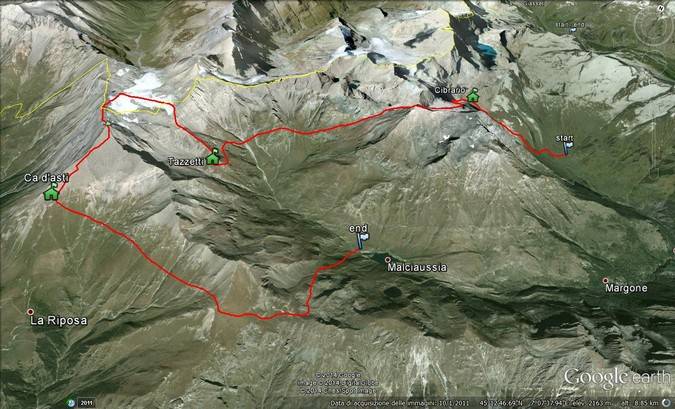
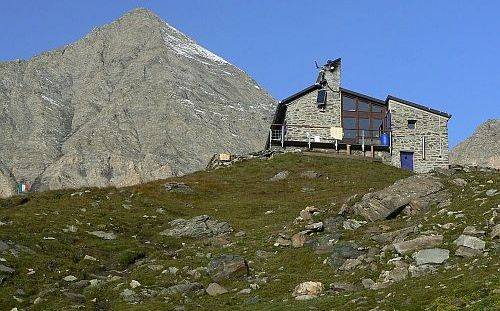
Usseglio (1550m) – Rifugio Cibrario (2616)m
3-4 hours – 4Km
Elevation up: 1100m Elevation Down: 0m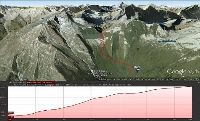
-
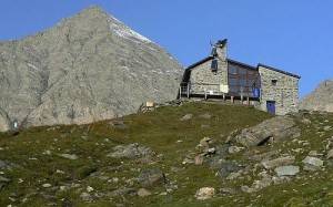
Rifugio Cibrario (2616)m – Rifugio Tazzetti (2642m)
5-6 hours – 8Km
Elevation up: 800m Elevation Down: 800m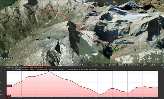
-
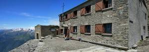
Rifugio Tazzetti (2642m) – Rifugio Ca d’Asti(2854m)
5-6 hours – 6Km
Elevation Up: 1100m Elevation Down:700m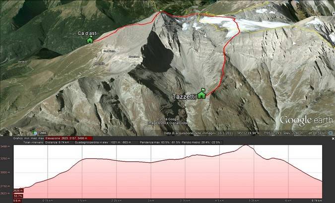
-
Rifugio Ca d’Asti(2854m) – Malciaussia(1840m)
5 hours – 9Km
Elevation Up:500m Elevation Down:1600m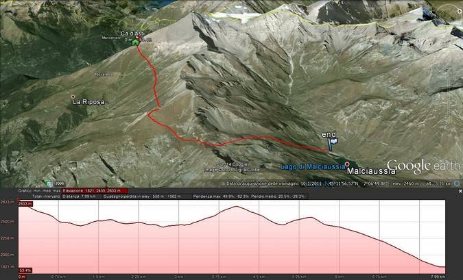
Join
A Planned Hike
A Planned Hike
This hike has not been booked yet
Why Join?
Join one of the planned hikes and save money sharing the costs of the trek with other people in our Alps trekking tour. Check the next mountain hiking tour in the Trekking Alps Calendar and plan your trekking in Italy with us. In joining an hike you will be part of a lovely international environment.Rocciamelone Peak Trekking
TESTIMONIALS
Great Trekking in the Alps
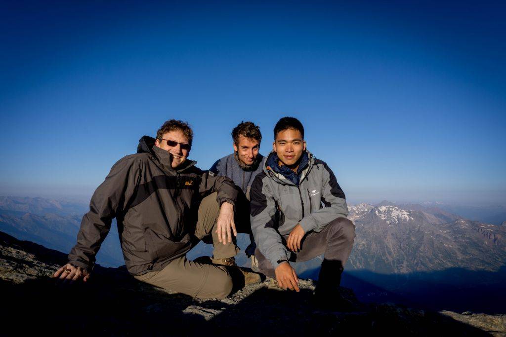
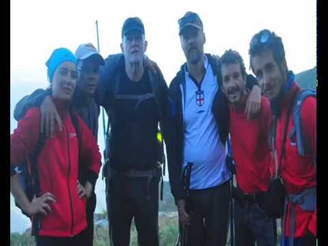
I have done 3 guided hikes with Roberto over the last few months. We went to Rocciamelone, Gran Paradiso and Monteviso in the Italian Alps. Roberto was a fantastic guide. Helpful, knowledgeable and above all fun. Whatever your ability or fitness he will design or suggest the hike best for you. I cannot recommend him enough. They were fantastic days in the mountains.
 Grant - United Kingdom
Simply Beautiful
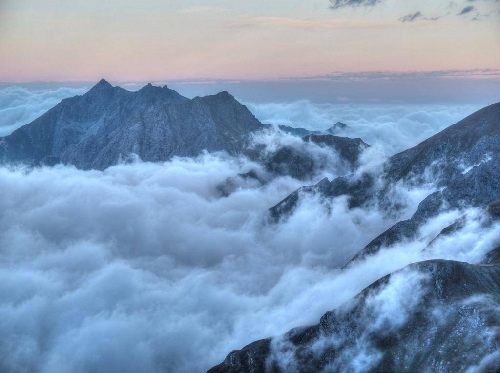
The two day hike of Rocciamelone was one of the most spectacular experiences I've ever had. I heard about Trekking Alps and Roberto from a friend who had gone on a hike with him and decided that this might be a good way to escape the heat of summer and satisfy my longing for great alpine scenery. The hike was relatively short but intense, and I loved every minute of it. We stayed at a lodge on the peak of the mountain and watched the sunset and sunrise at 3500m. The views were unbelievably breathtaking! Roberto is not only a fantastic and accommodating guide but also an awesome guy to hike with. I would definitely recommend him if you are looking for an unforgettable adventure!! I only wish I could go again!
 Ethan - Taiwan
